Uebersichtspläne der Ausgänge und Umgebung diverser U-Bahn Stationen in Paris |
||
Maps of the exits and area map of important Paris underground stations |
||
Plans des sorties et plan du quartier des principales stations de métro à Paris |
||
|
STATION |
||
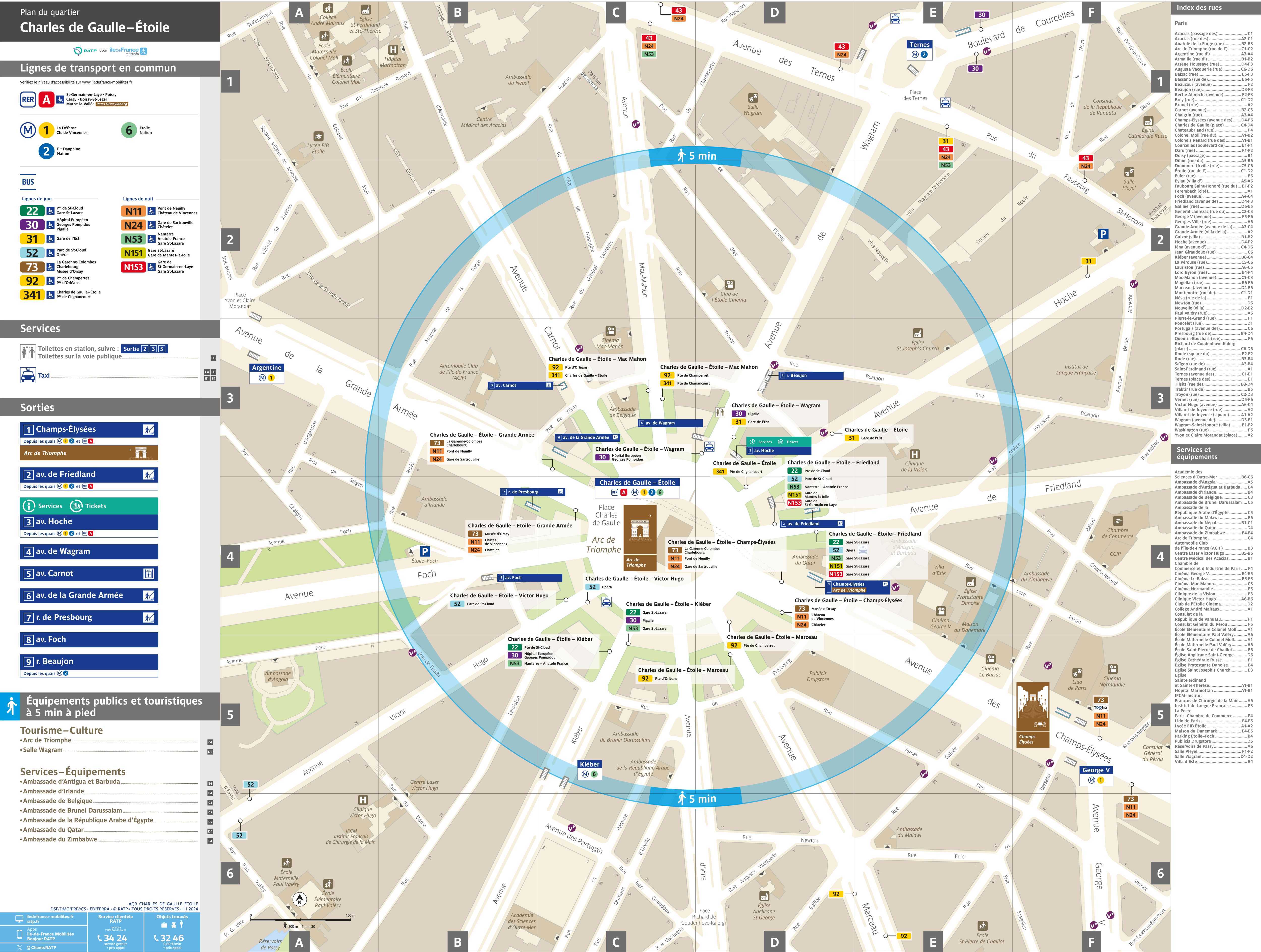
| Charles de Gaulle-Étoile | Uebersichtsplan Ausgänge U-Bahnstation Charles de Gaulle-Étoile, Paris, Frankreich, JPG-Format | |
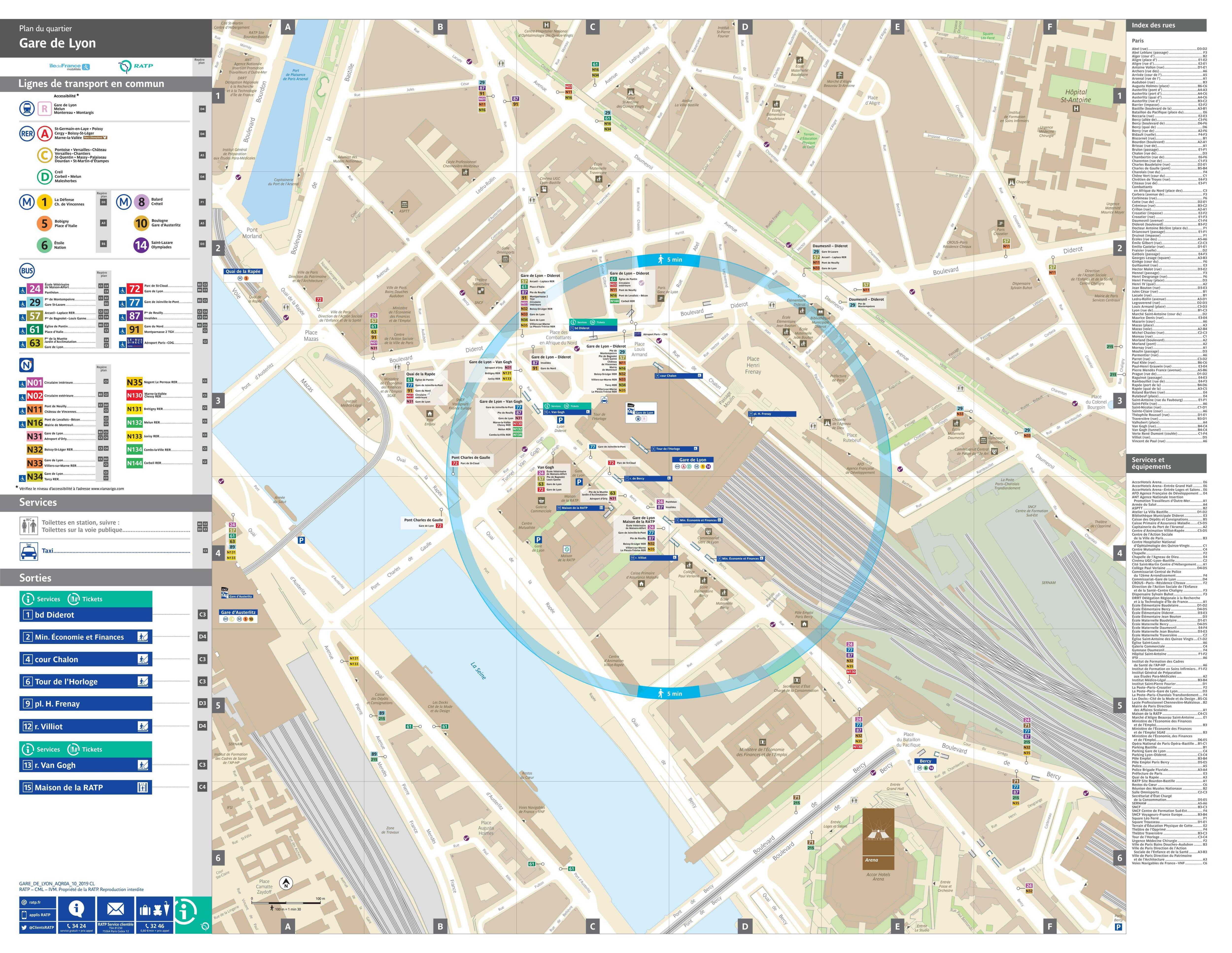
| Gare de Lyon | Map of exits of underground and train station Gare de Lyon, Paris, France, JPG-file | |
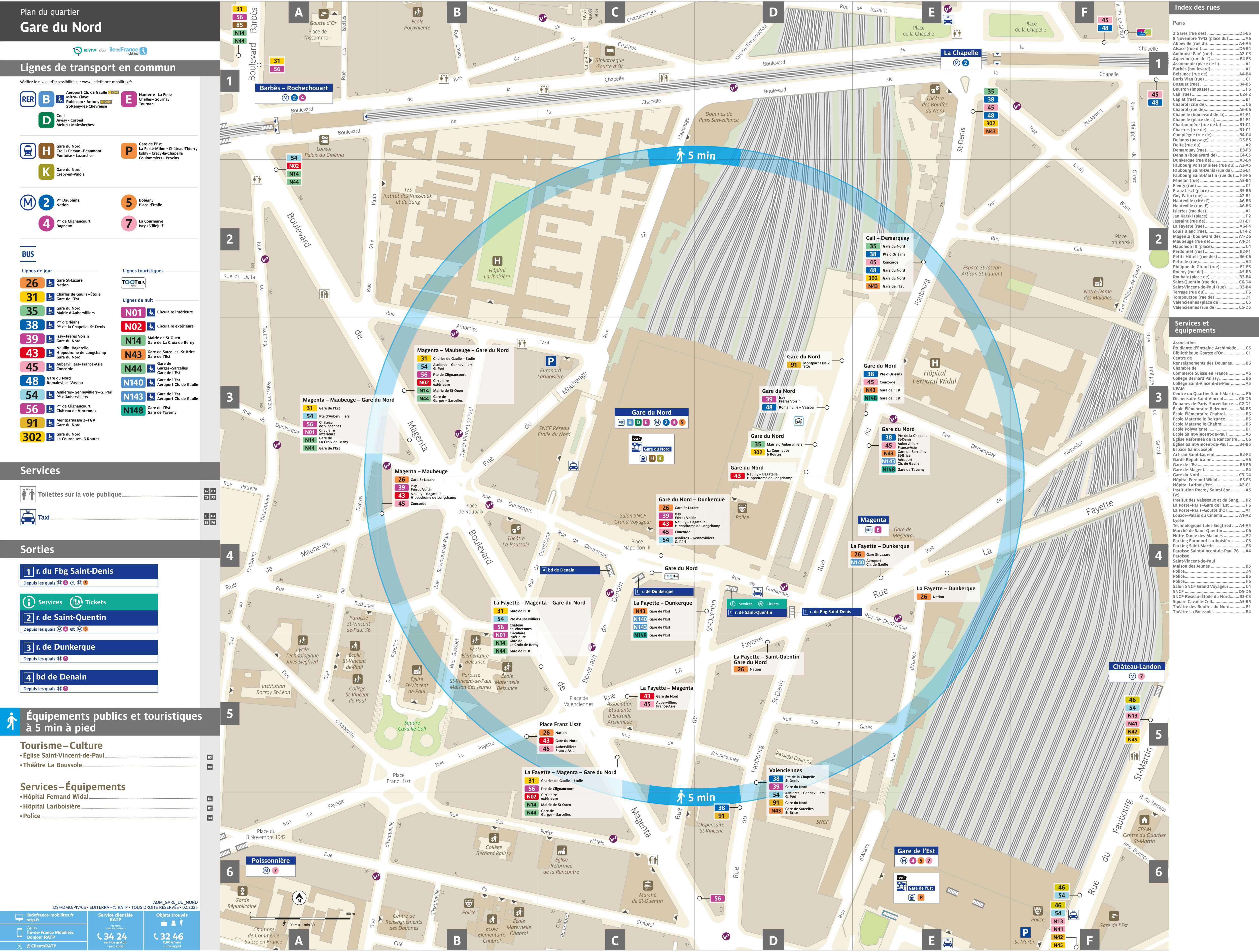
| Gare du Nord | Plan général des sorties de la station de métro Gare du Nord, Paris, France, format-JPG | |
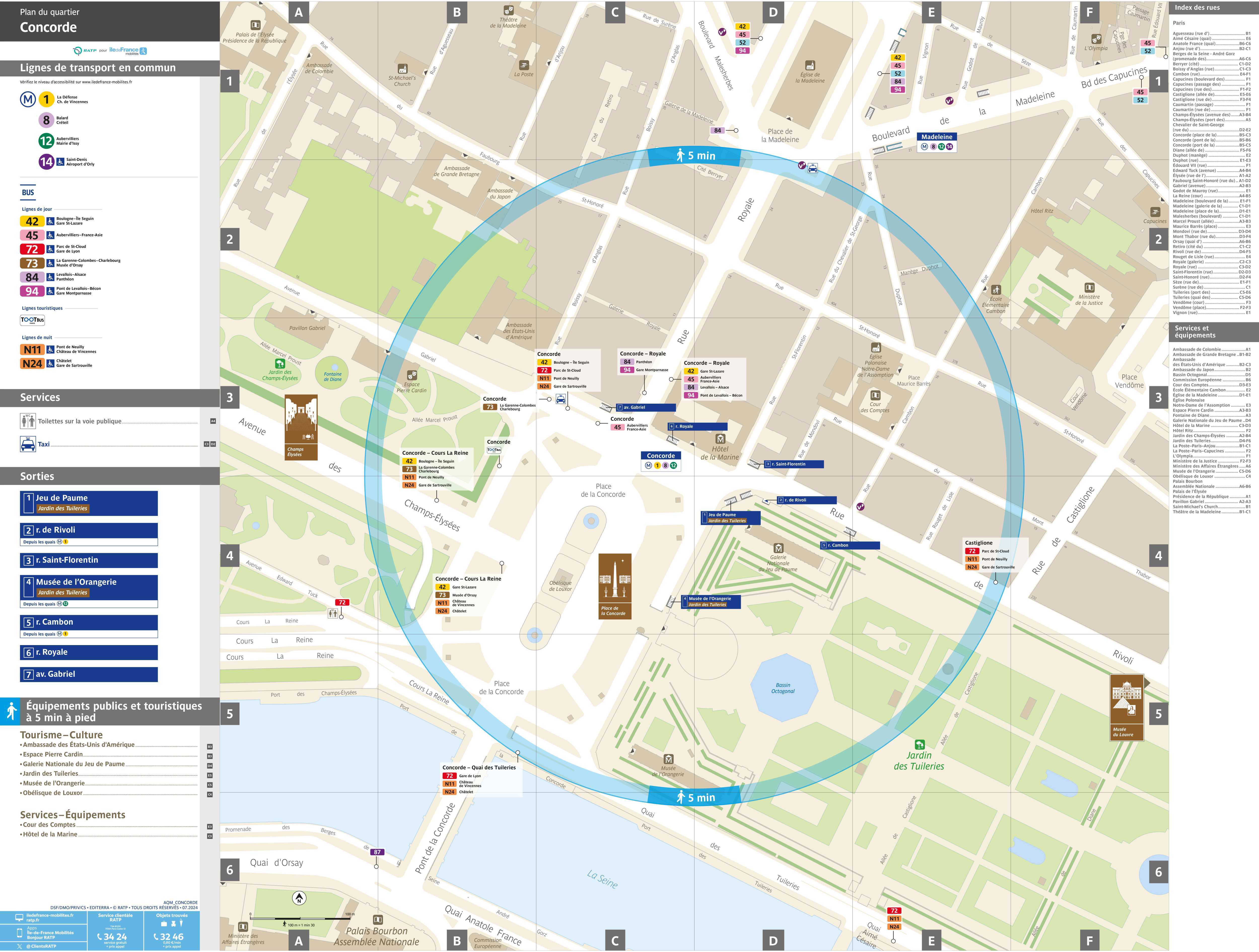
| Concorde | Place de la Concorde, U-Bahn Ausgänge, underground exits, metro sorties, JPG | |
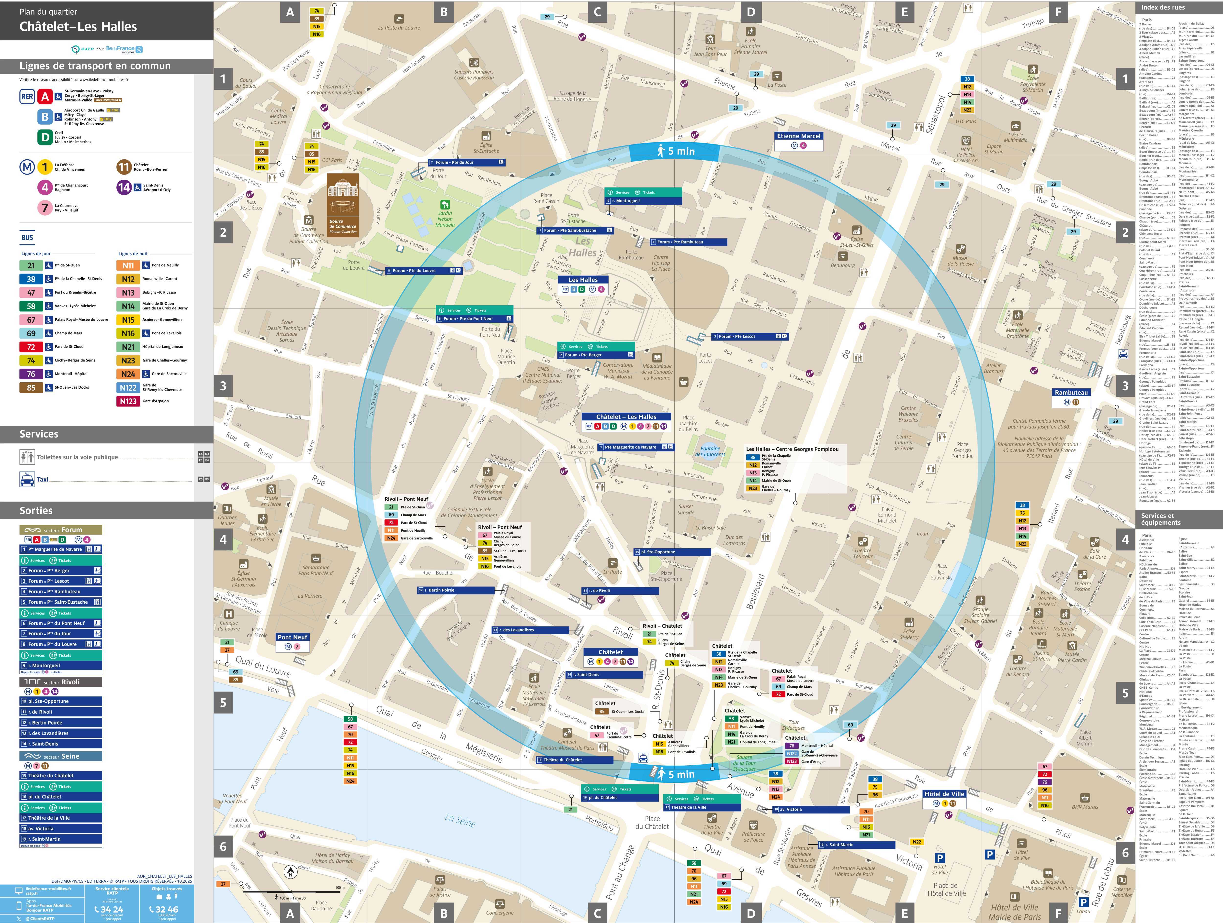
| Châtelet | Map of exits of underground station Châtelet, Paris, France, JPG-file | |
| Les Halles | Umgebungskarte, Local Area Map, Plan du quartier, JPG | |
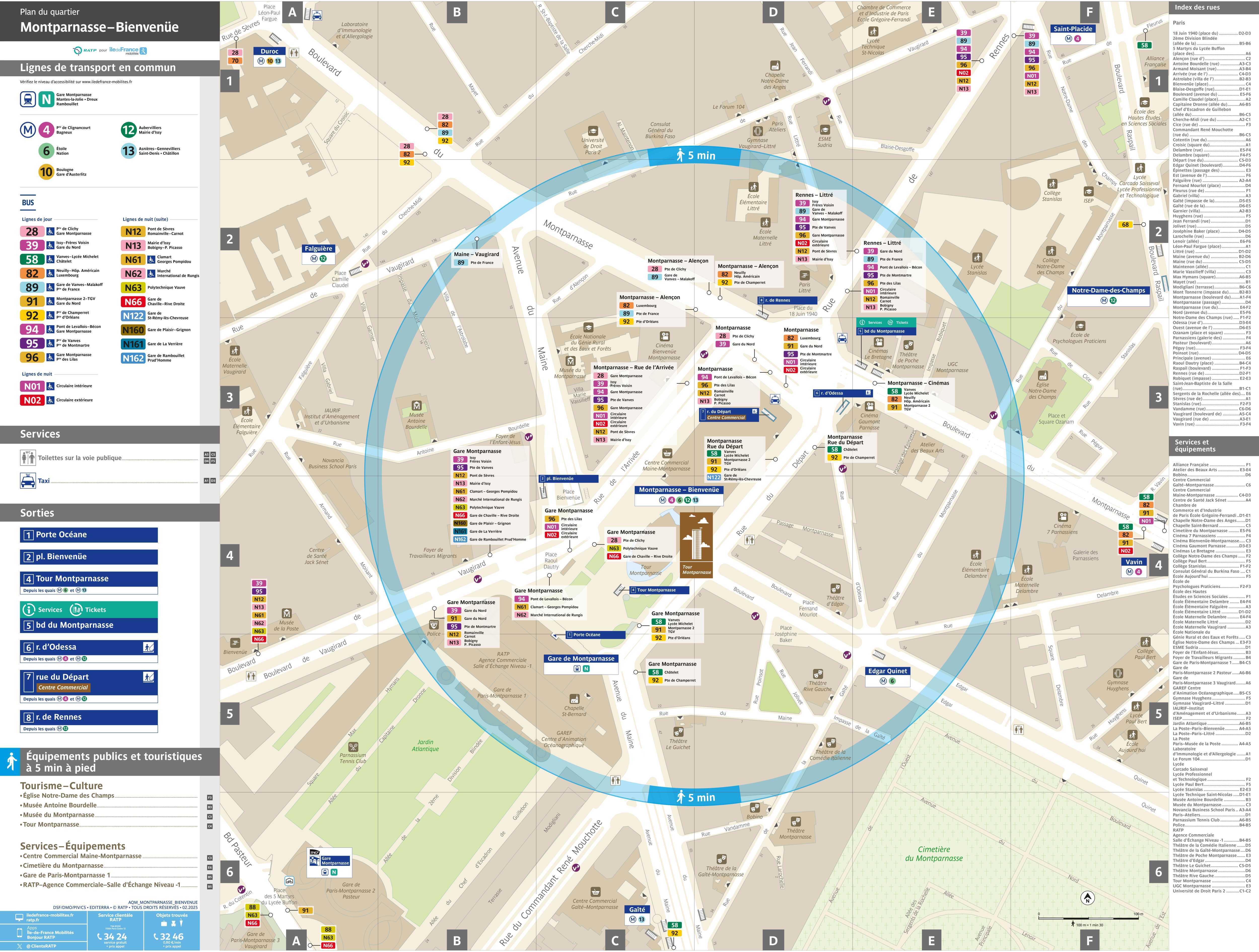
| Montparnasse | Übersichtsplan Ausgänge Bahnhof und U-Bahnstation Montparnasse, Paris, Frankreich, JPG-Format | |
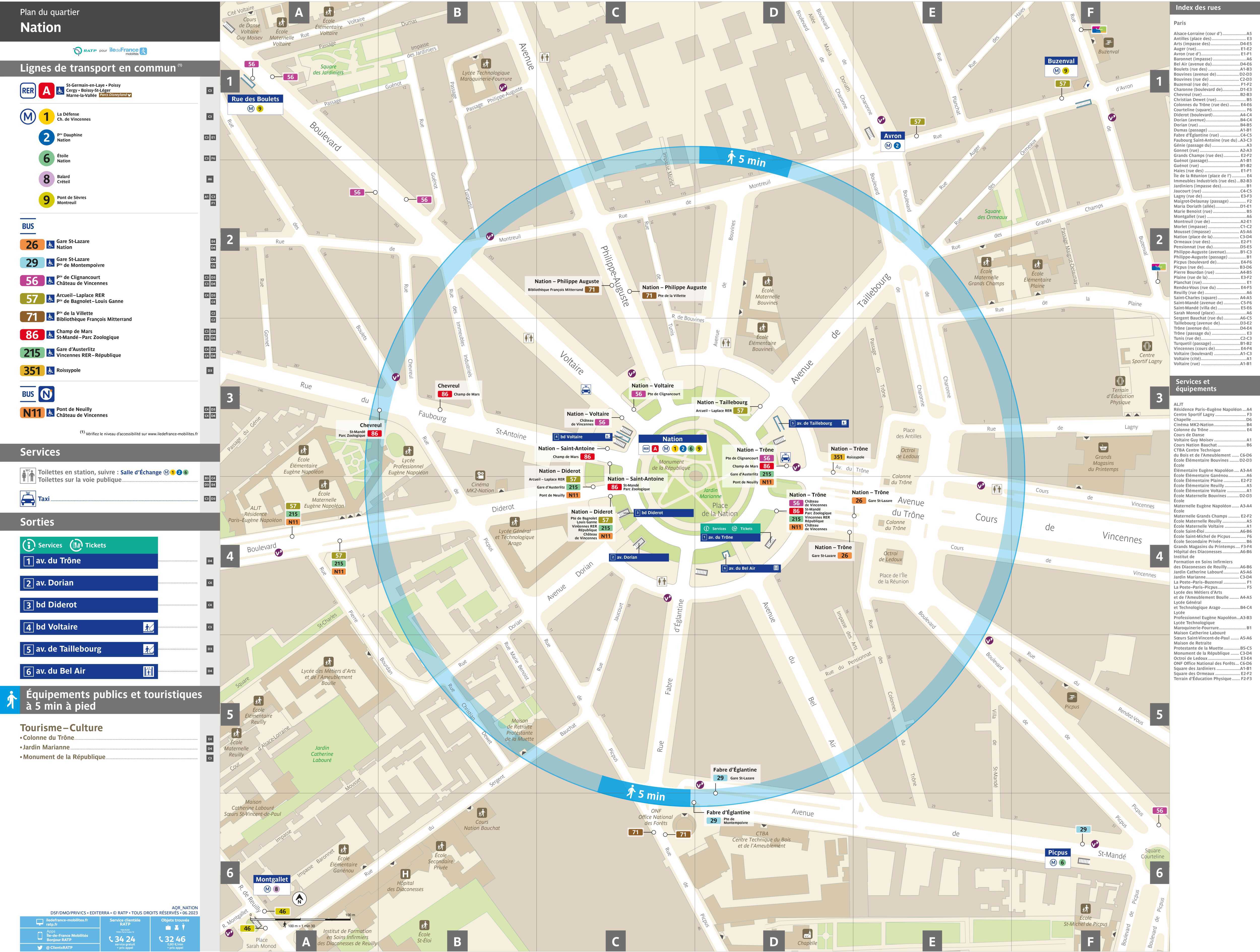
| Nation | Map of metro exits of metro station Place de la Nation, Paris, France, JPG-file | |
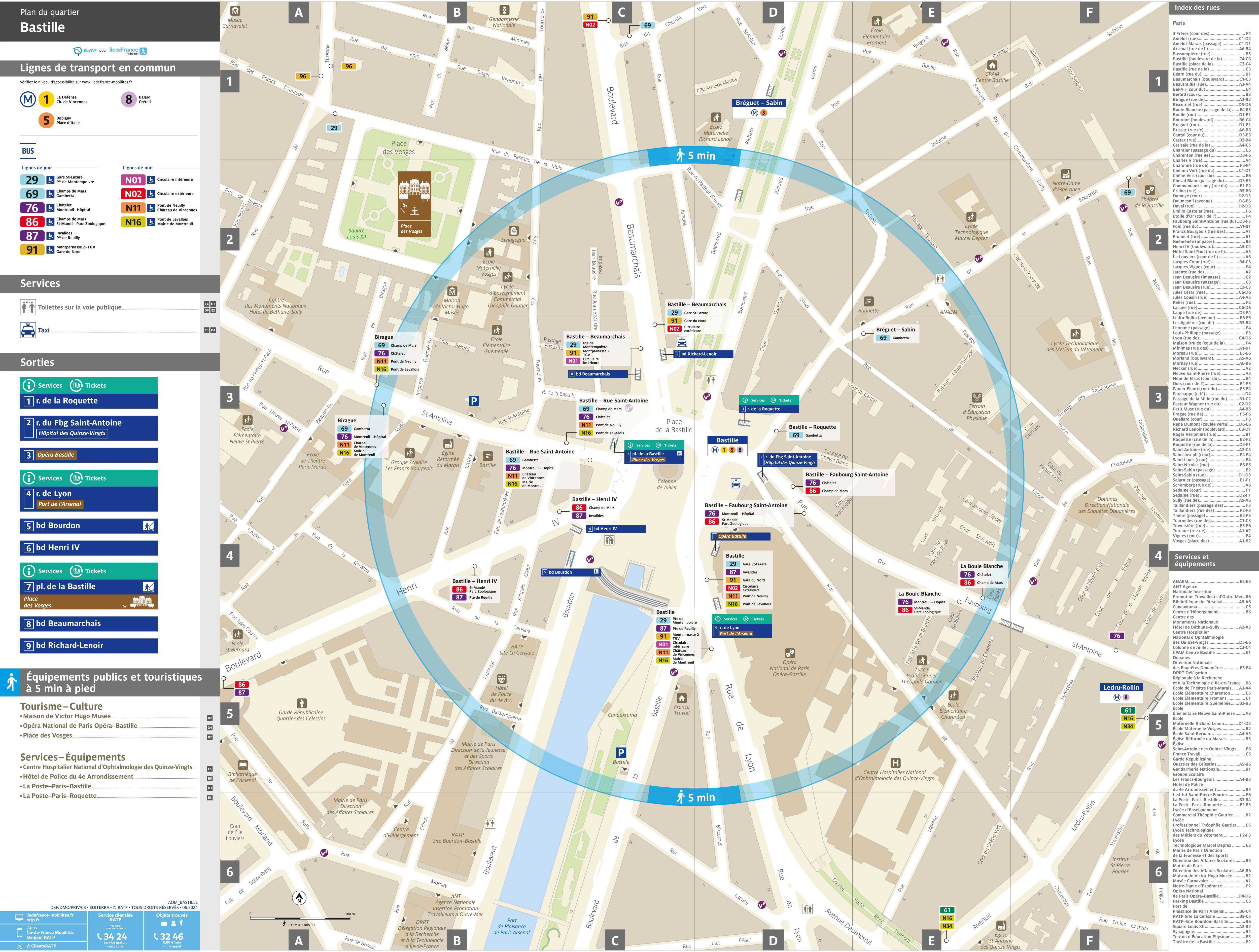
| Bastille | Plan général des sorties de la station de métro Place de la Bastille, Paris, France, format-JPG | |
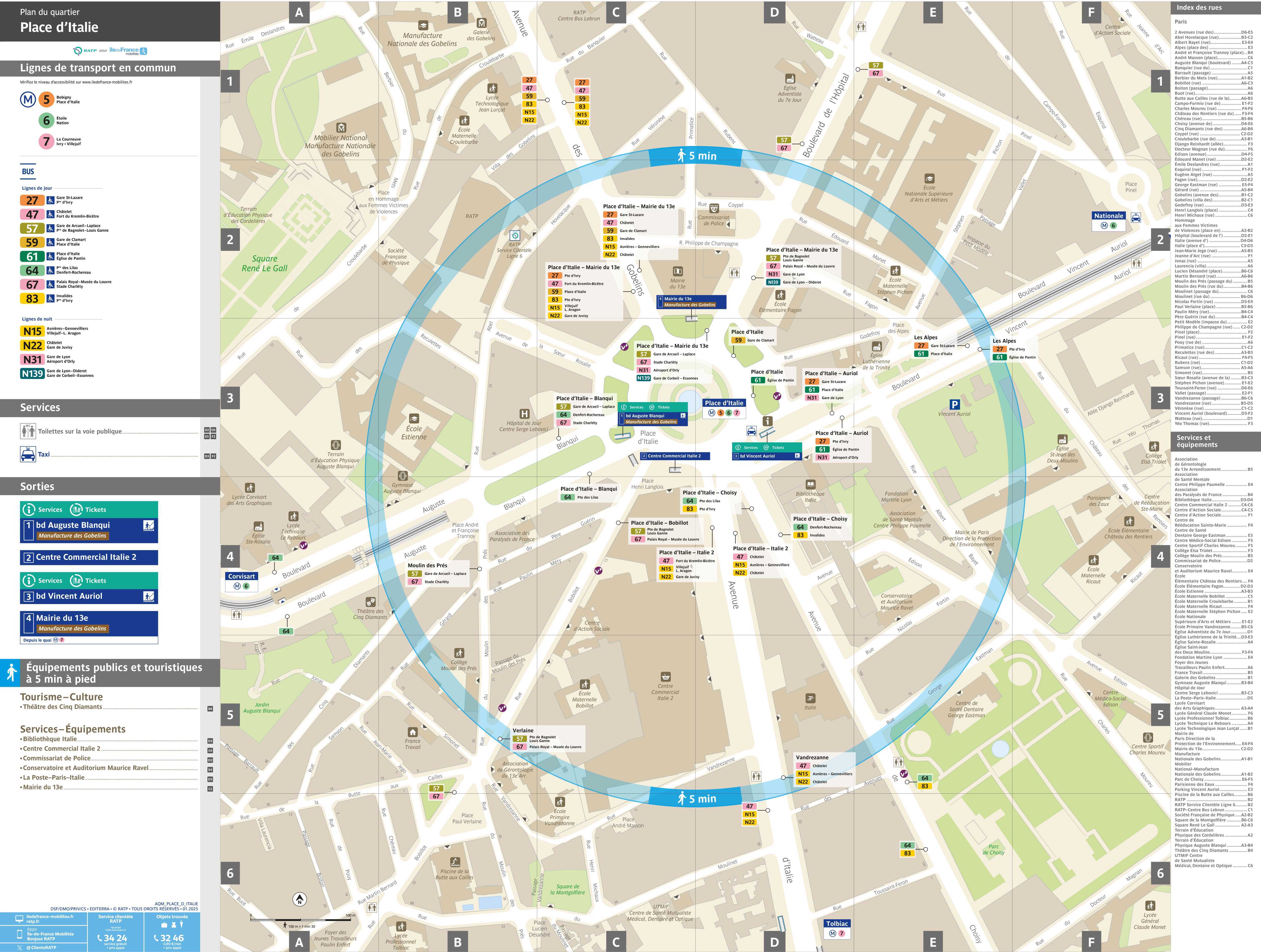
| Place d'Italie | Uebersichtsplan Ausgänge Metro Station Place d'Italie, Paris, Frankreich, JPG-Format | |
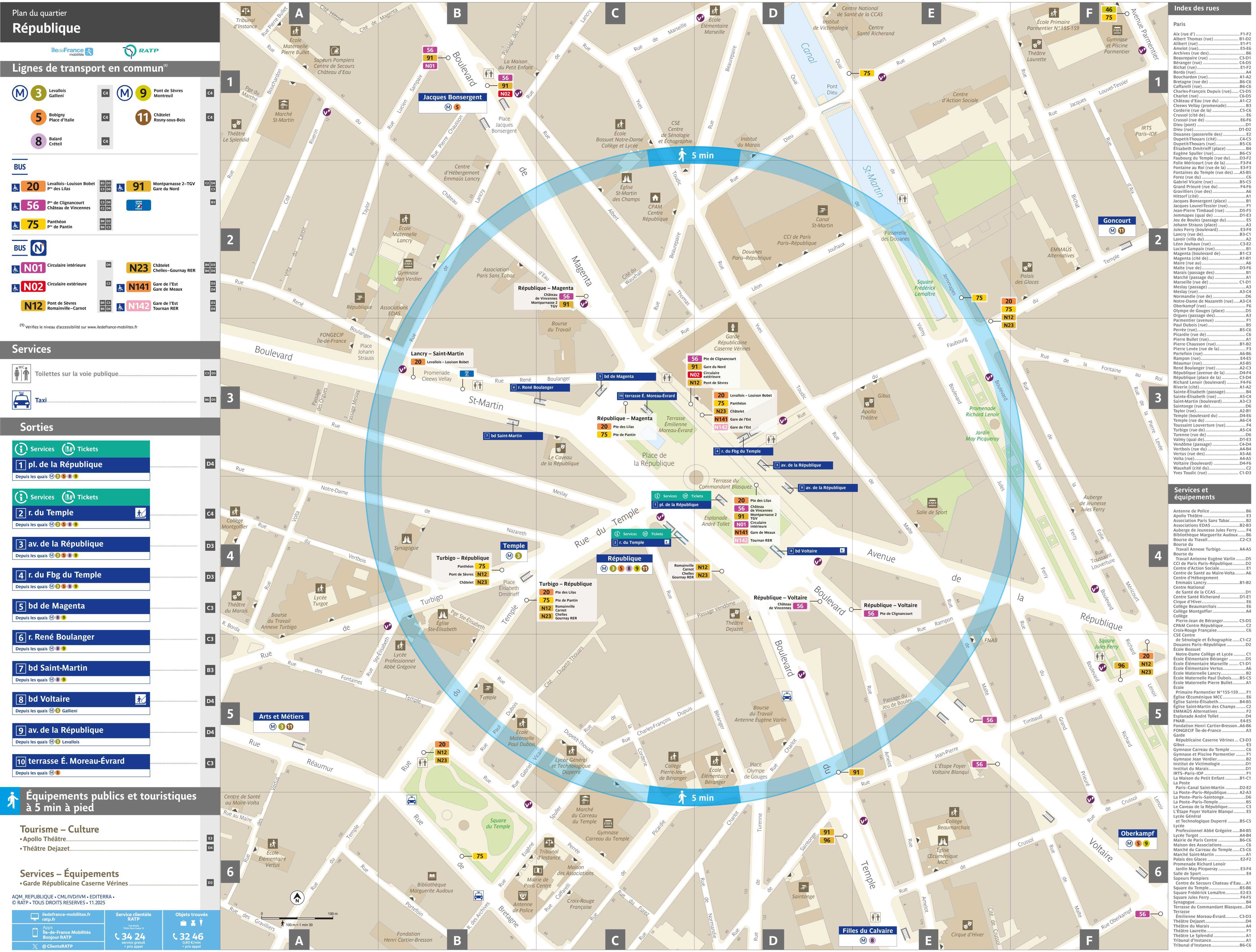
| Republique | Plan général des sorties de la station de métro Republique, Paris, France, format-JPG | |
Detaillierte Informationen zu allen Metrostationen in ParisDetailed information on all metro stations in Paris

|